Amazon Deforestation, Province of Chiquitos
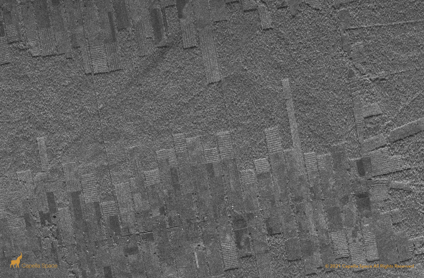
Capella’s wide swath Stripmap imagery reveals strip cut deforestation of Amazonian virgin forest. In it’s place, SAR data reveals what appears to be planted vegetation in newly formed agricultural land. When analyzing SAR data, naturally occurring forests appear in rougher patterns. The strip cut areas look artificial, showing straight lines of re-planted trees that don’t […]
Antarctica Strip Universal Polar Stereographic (UPS) – Stripmap
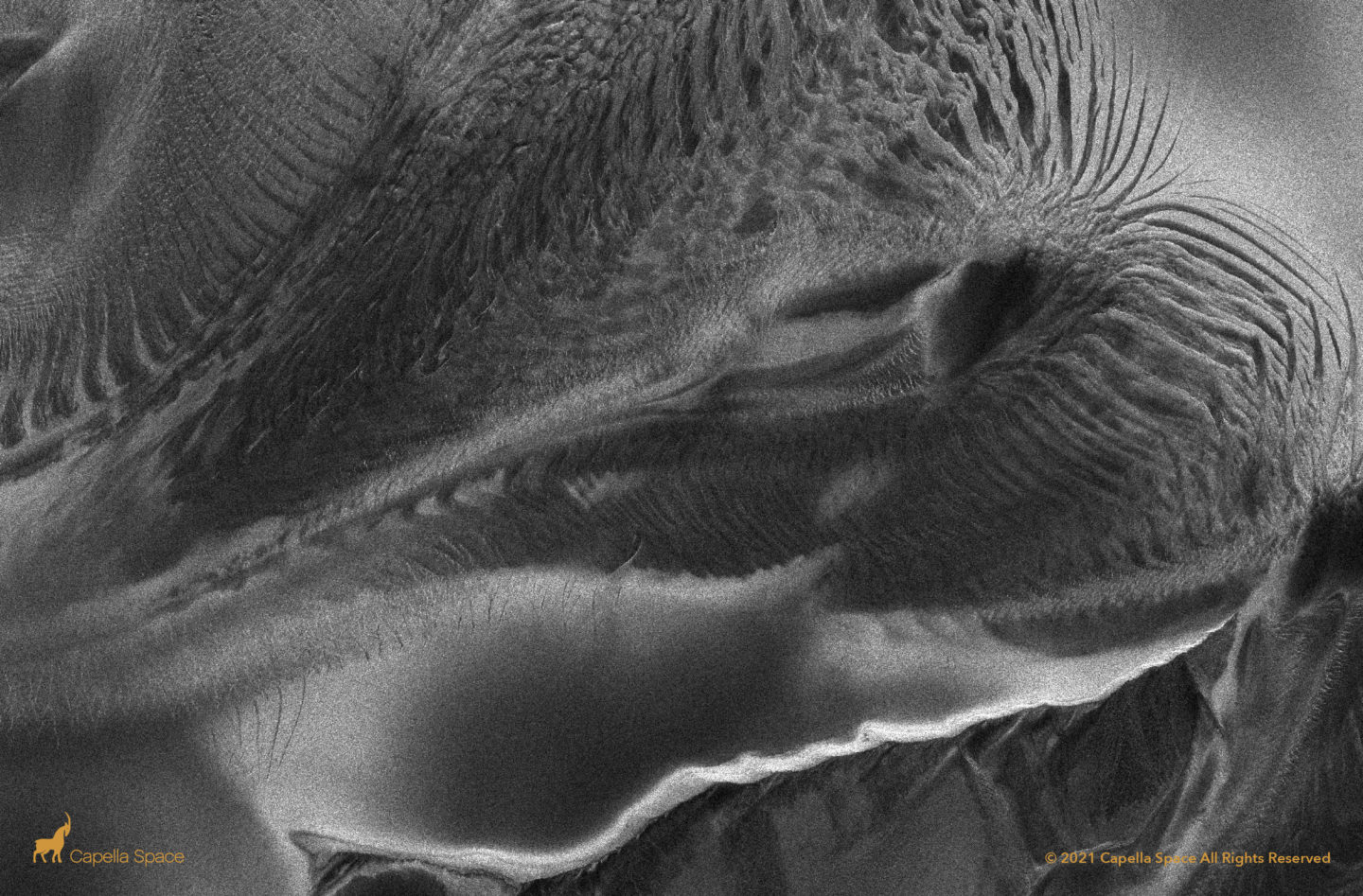
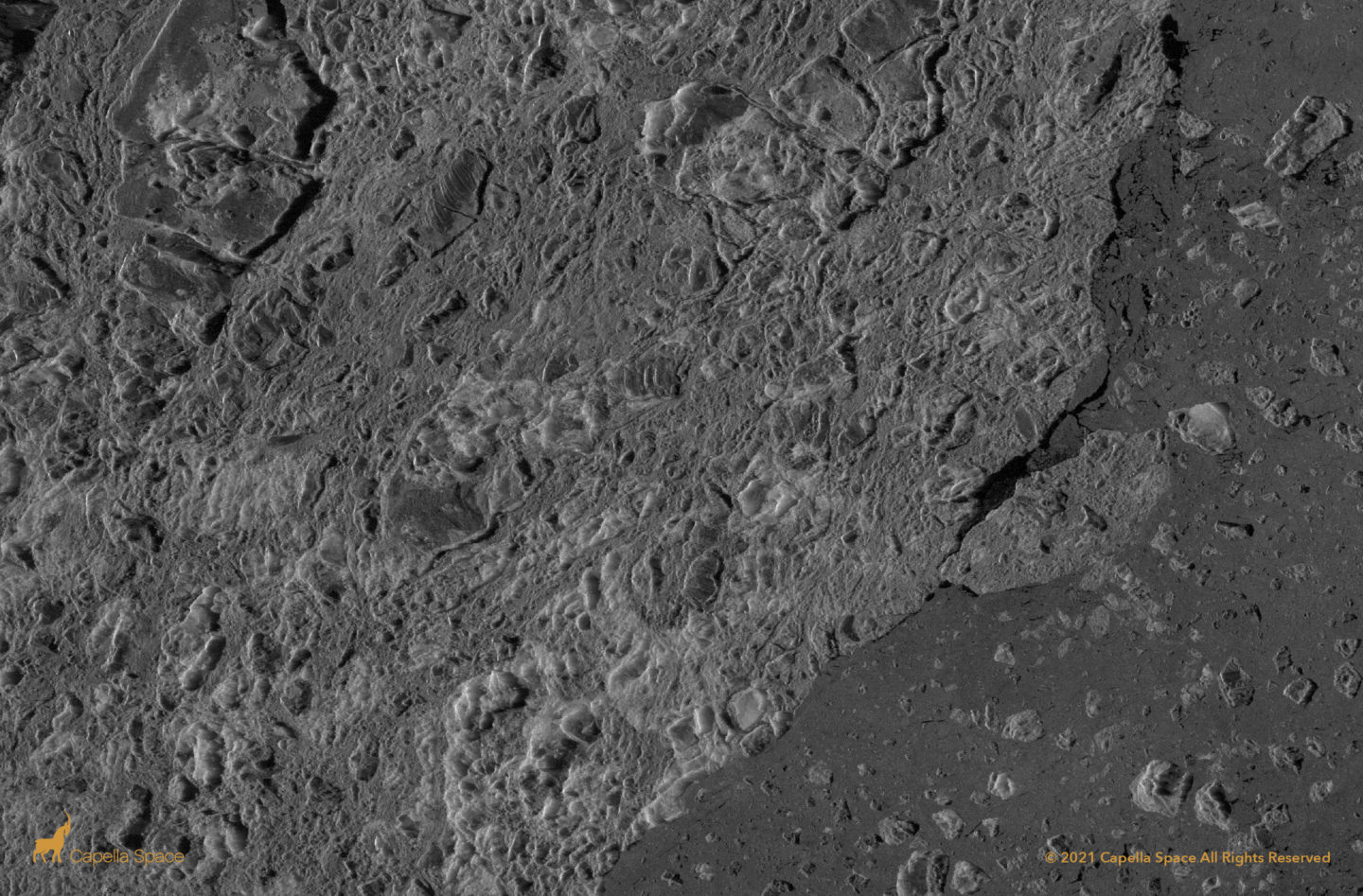
Antarctica Ice Shield & Weddell Sea
This is the Antarctic Ice Shield, bordering the Weddell Sea. In early 2021, the world’s largest iceberg, named A-76, broke off of Antarctica’s Ronne Ice Shelf into the Weddell sea. SAR technology can provide real-time data for iceberg monitoring, which is important for maritime navigation and environmental purposes.
Amazon Deforestation, Luna Camba
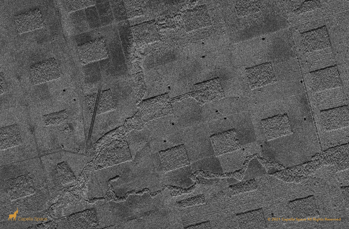
In this image, you can see deforestation in the Amazon Rainforest. Deforestation in the Amazon Rainforest is difficult to monitor at scale due to the size and opacity of the region, which often is obscured by cloud cover. Capella’s 24/7, all-weather Stripmap imagery mode uses a wider swath to detect high-resolution changes such as land […]
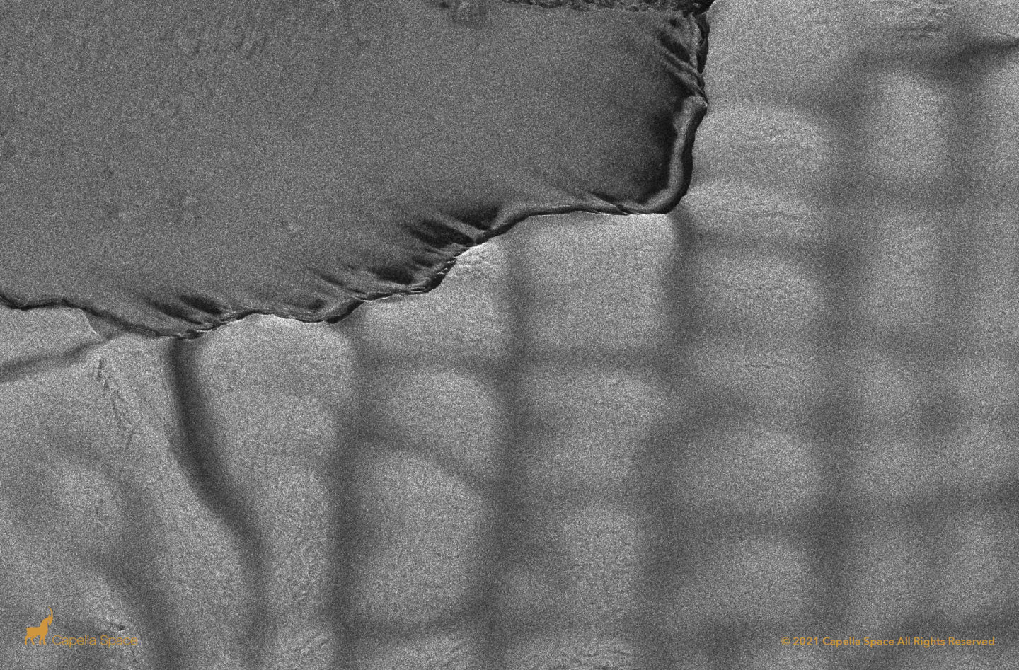
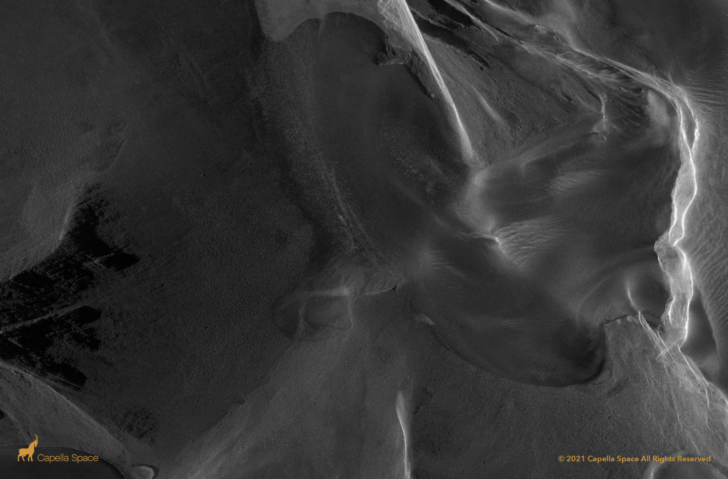
Icebergs Calving From Helheim Glacier
The Helheim Glacier’s calving face can be seen in this image as of April 8, 2021 with intact chunks of ice breaking off into a fjord in Greenland, denoted by darker areas in 50cm very high resolution SAR imagery as the glacier shifts eastward into the water. The Helheim Glacier is very fast moving, and […]
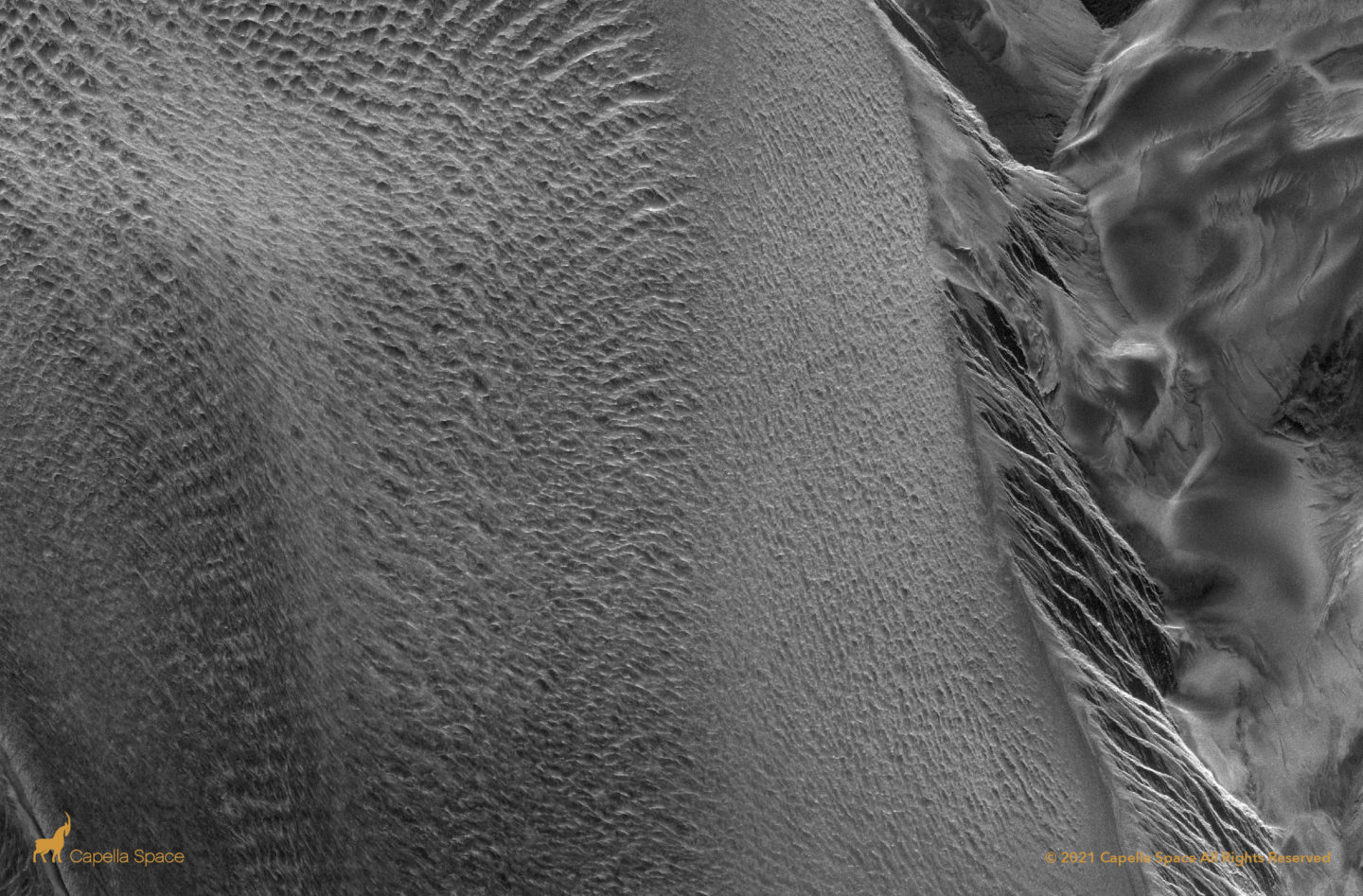
Antarctica Spot Universal Polar Stereographic (UPS) – Spotlight
Antarctica Site Universal Polar Stereographic (UPS) – Sliding Spotlight